Sunday, May 23, 2010

Mt Donald

Yesterday gave the missus and a couple of friends a lift to Hill Cove for a yoga class, didn't fancy it myself so took the opportunity to have a walk up Mt Donald, the westernmost hill of the Mt Adam massif.
Don't usually do much in the winter but it's been a good spell of weather and on the day it was stonking! no wind to speak of and bright sunshine apart from a period of mist while I was on the ridge.

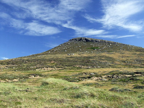
Mt Donald from the north, doesn't look like much from here but a tough walk up the spur on the left through some big ferns and higher up some stone runs. As with most hills here there's no path as such, just choose a place to aim for and go.


Those ferns are big! the climate in this part of West Falkland is a lot more beneficial to plants than the harsh conditions where I live at Fox Bay, the vegetation is much more of an obstacle on these hills.


Higher up the spur (1200 ft ish), terrain is steeper and many small stone runs to cross, hard going. Overturning a rock up here I spotted a small wolf spider about 3/4 inch long and appeared to be translucent, scuttled off pretty quick so was unable to get a photo of it unfortunately.


Got there, looking north from the top of the spur, one of the best veiws on the West on a clear day and they don't get much clearer than this. Hill Cove settlement is on the promontary on the left, beyond to the right is the Sound Ridge and then L to R Saunders Island, Keppel Island and Peddle Island.
The top of Mt Donald is a plateau with 3 high points at 1900 to 2000 ft and several ponds between in very wet, boggy ground, It's an uninteresting summit but the veiws are spectacular. To the West is a rocky ridge that runs for several kilometres then drops away steeply to the pass at Hells Kitchen where the road crosses, this is where I'm heading.


The West Ridge in the mist, quite thick below and the sun shining through, only lasted for 20 minutes or so, I was hoping I might have seen my first ever brocken spectre but sadly not to be.


Looking West from the end of the ridge, The French Peaks and the Boundary Hills, in the distance is Byron Heights. To the right is the pass at Hells Kitchen, from the ridge is a steep descent then scrambling through a few crags lower down (easily circumvented but fun to scramble). From there I rejoined the road and walked back to Hill Cove settlement.


A great day out, If only we got weather like this in the summer. ;-)


Tuesday, February 9, 2010

Mt William & Mt Tumbledown

Just back from Christmas in the UK and stuck in Stanley for a few days so I thought I'd head out onto a couple of the nearby hills.
These East Falkland peaks are of a different character to the big hills of the West, low craggy tors with gentle slopes and tops of great slabs of shattered quartzite. The valleys are riven by stone runs, those strange peri-glacial rivers of stone that the Falklands are renowned for, in these East Falkland Hills the stone runs are far more prevelant than on the West.
First up is Mt William, an hours brisk walk from Stanley to the summit at 900 feet, this hill is impressive from a distance, a great double ridge of vertical strata (to me it brings to mind the backbone of a stegosaur). On top there are large, steep slabs forming at least 3 high points and I would hesitate to say which is the true summit, not unusually for these hills there are landrover tracks right to where the crags begin.
From Mt William the neighbouring Mt Tumbledown looks well named, a hulking mass of broken stone with none of Mt Williams elegant structure, however having crossed the valley and walked up the gentle southern slope Tumbledown begins to show its true character. Great broken steps and slabs lead up to the highest Western part of the massif , the higher you get the more interesting it becomes.


On top is the real treat, the view that opens up to the East overlooking the fantastically twisted strata of the north face towards Stanley Harbour and Port William is breathtaking, the ground drops away in a cliff to the North, several hundred feet, down to scree and the attractive patches of giant ferns that grow on the high ground. A red backed hawk appears riding the updraught and hovering not 20 feet away, way beyond my skill to photograph, just a treat I'll remember.
As I head east amongst the huge boulders and slabs that form Tumbledowns summit then more and more evidence of the mountains history appear, a corroding rocket launcher, the remains of tent poles from the Argentine bivouacs, a small cairn in the lee of a great boulder (could only be a marker for one of the men who died fighting on this peak), finally on the Easternmost end of the ridge is the memorial for the Battle of Mt Tumbledown, a simple cross on the very end of the crag. I stopped below here for my lunch, rather subdued by the thought of what took place here nearly 29 years ago. Here I was visited by one of my favourite local birds, a dark-faced ground tyrant, who as they usually do posed for a photo. From here an easy descent down over the lower, secondary peak of Tumbledown to Moody Brook and so back to Stanley.

Tuesday, July 7, 2009

Birds!


A few shots of some local birds (the feathered kind).

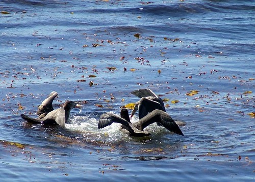
Giant Petrels fighting over some dead thing.


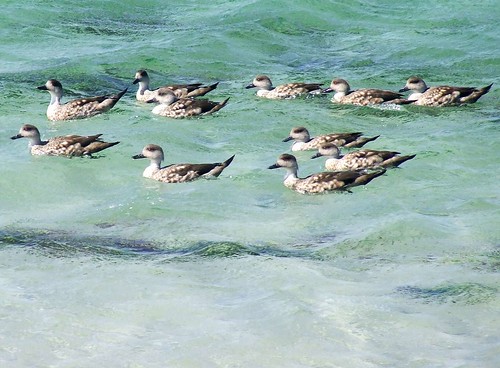
Grey ducks, sand beach at Rincon Ridge


Speckled Teal, the North Arm, Fox Bay


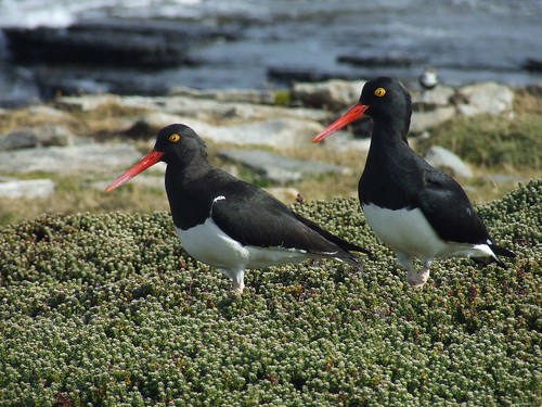
Magellanic oystercatchers, Fox Bay


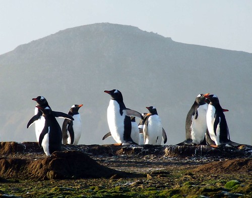
Gentoo Penguins, East head of Fox Bay in the distance.


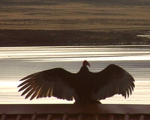
Turkey Vulture warming itself in the sun


Pair of Grey ducks feeding, Sand Pond


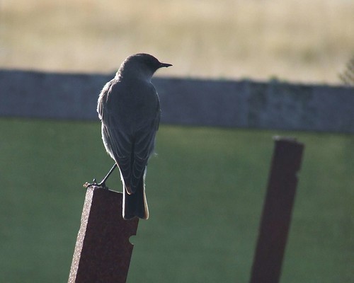
Dark-faced ground tyrant, my favourite bird.


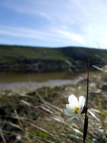
Pale Maiden, National flower of the Falkland Islands
(not a bird I know, I just like the photo)


Tuesday, June 30, 2009

Stephens Peak

The Peak, from the north.


A littlie but a goodie. At the southern end of West Falkland lies Port Stephens, the attractive harbour is sheltered from the Southern Ocean by a hilly peninsula and the most distinctive of these is the 700 foot Stephens Peak, 'the Peak' as its referred to has 2 distinct rocky summits connected by a saddle. Further along the peninsula to the east is the unusual rock formations of Indian Village, to the west is the sand beach of Wood Cove and beyond impressive sea cliffs culminating in Calm Head.

Approached from the north its an easy walk up to a large gorse bush about half way up, it then gets pretty steep to the first peak with a little bit of a scramble if thats your thing. The exposed quartzite of the peak is fantastically eroded by the prevailing wind, very different from the outcrops further inland. Between the 2 peaks is a grassy saddle that almost appears to be mown (I guess partly due to the rabbits that inhabit the area, much to Booms excitement).


Wood Cove, can't see from the photo but theres a big Gentoo penguin colony down there.

Eroded quartzite on the second peak.


Second peak, from just below the saddle.


Looking across Port Stephens to the NE from the sandbeach below the peak.


Calm Head, over 700 feet high, been there but didn't have the nerve to go out onto the head itself (very narrow indeed)


Looking over Port Stephens toward Mt Alice in the distance.


Me & Boom on the top, very windy.


Friday, June 26, 2009

Mt Adam

Mount Adam is by a small margin the loftiest of the hills on West Falkland, at 2,297 feet its no giant on the scale of things but a harder walk than it looks. It is one of the five peaks that make up the most distinct part of the Hill Cove Mountains, running from the saddle in the east to the pass at Hells Kitchen in the west these hills bear the scars of glaciation, sharp ridges, corries, tarns and deep valleys running to the north. Most of the character is hidden, from the south they have a rounded look similar to Philomel or Sulivan and from the north they are mostly concealed by long ridges running to the sea. Running from east to west are Mt Robinson, Miss Robinson, Shingly Mountain, Mt Adam and Mt Donald. Adam, Mt Robinson and Shingly Mt are respectively the 3 highest hills on the West.

Adam is connected to its neighbours by a saddle each side at about 1,200 feet, There are 2 summits, One to the east (2,250+ feet) marked with a standing man and 3/4 of a kilometre to the west one with a spot height of 2,297 feet, Here there is a derelict MOD installation that is still mostly intact though deteriorating badly, this consists of a helicopter pad, fuel tanks, and generator and accomodation units (on my first visit to this peak in foul conditions the shelter this provided was most welcome). To the north of the summit ridge is a rocky edge and a steep slope into a pair of corries and tarns, the ridge sweeps round from the west to the north dropping then rising again to a third high point at about 2,000 feet, the corrie below this prominence is impressive, the back wall falls 500 feet to the larger, northern tarn.

Theres no easy way to approach Mt Adam, there is a well defined but rough track from the north which looks reasonable but is a fair distance from the Hill Cove/Shallow Bay road (I've not tried that route yet) or there is the option to approach from the south which is a reasonable distance from the road but involves crossing some difficult ground, knee high, sometimes waist high diddle-dee, overgrown streams and holes and as you get higher up the southern slopes, steep yet saturated, mossy ground which is a pain to climb. On this occasion Andy and I drove halfway up the neighbouring Mt Donald and walked from there. Once one is past the obstacle of the southern slopes the walking is great with lovely views as you follow the ridge round. The weather was overcast and thundery but blessedly calm.


Looking east from the summit toward the second peak along the east ridge, the hill to the left is Shingly Mt and just visible are the tops of Miss Robinson and Mt Robinson, beyond in the distance are the Hornby Mountains.

North Corrie & tarn from the summit.
Me & Boom at the twin standing men on the summit.
View to the south, Mt Philomel on the left.
Mt Adam from the ridge above the north corrie.

Thursday, June 25, 2009

Mt Philomel, September 2008

Mt Philomel is a hill to the south of the Chartres estuary, its distinctive, rounded twin peaks dominate the lower hills of the surrounding area. The quartzite rock that makes up these hills is in 2 distinct layers and this shows as a clear terrace on larger hills such as Philomel. There is no trig point or obvious marker except for the foundations of an MOD installation on the western summit, On the OS map of the area Philomel has no spot heights marked so elevation is indicated only by the 1950 foot contours on each summit, my GPS read gave a reading of 2,150 feet (a nonsensical figure, I am dubious of the accuracy of the altimeter). To the east is a saddle joining to a pair of lower hills (approximately 800 feet) and to the northwest is steep ended ridge of 5 kilometres descending from 1500 to 1000 feet before falling sharply away to a stream flowing into the estuary.

The walk covers a distance of 13.5 km with no paths apart from an indistinct vehicle track on the saddle to the east, there is about 2,100 feet of ascent altogether. A rough approach across white grass flats from Dunnose Head junction to to reach the hill in the centre of the photo, cross a saddle at approx 700 feet to climb the eastern end of Philomel, The final 800 feet is steep enough to make zig-zagging necessary. Cross the 2 summits and then descend via the northwest ridge, at the end of this ridge is a small standing man covered with impressive growths of feathery lichen. The summits and ridge lack any substantial outcrops but are quite stony with patchy scree on the slopes, an interesting feature particularly to the western end of the massif is the presence of quite a bit of iron lying around in rusty nodules. After descending the scree slope at the end of the ridge follow a stream to rejoin the road opposite Chartres settlement, this valley is pleasant change after the wind blasted terrain of the ridge.


Grand weather but windy, This is looking East from Philomel, across the watershed of the Chartres river to Mount Moody and the Shag Cove Mountains in the distance.


Above is the view looking north to the Hill Cove Mountains from the end of the NW ridge, from left to right are Mt Adam, Shingly Mt, Miss Robinson and Mt Robinson. The body of water in the foreground is the Chartres estuary and Chartres settlement is visible on the left.
Below is the Northwest ridge from the top of Philomel, looking out over Christmas Harbour, in this photo the nature of the rock layer shows clearly as the slope levels into a terrace at approximately 900 feet. The wind was brutal on the ridge, blowing straight across at approx 40 - 50 knots, further down the slope was reasonably sheltered but the steepness made walking more difficult than the wind did on top of the ridge, at one point I had to
hit the deck to hold on in a particularly violent gust.


This is typical of the terrain on the ridge, quartzite rocks, sand, small diddle-dee plants and balsam bogs.