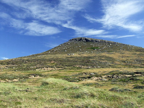
Mt
Philomel is a hill to the south of the Chartres estuary, its distinctive, rounded twin peaks dominate the lower hills of the surrounding area. The quartzite rock that makes up these hills is in 2 distinct layers and this shows as a clear terrace on larger hills such as
Philomel. There is no trig point or obvious marker except for the foundations of an MOD installation on the western summit, On the OS map of the area
Philomel has no spot heights marked so elevation is indicated only by the 1950 foot contours on each summit, my GPS read gave a reading of 2,150 feet (a nonsensical figure, I am dubious of the accuracy of the altimeter). To the east is a saddle joining to a pair of lower hills (approximately 800 feet) and to the northwest is steep ended ridge of 5 kilometres descending from 1500 to 1000 feet before falling sharply away to a stream flowing into the estuary.
The walk covers a distance of 13.5 km with no paths apart from an indistinct vehicle track on the
saddle to the east, there is about 2,100 feet of ascent altogether. A rough approach across white grass flats from
Dunnose Head junction to to reach the hill in the centre of the photo, cross a saddle at approx 700 feet to climb the eastern end of
Philomel, The final 800 feet is steep enough to make
zig-
zagging necessary. Cross the 2 summits and then descend via the northwest ridge, at the end of this ridge is a small standing man covered with impressive growths of feathery lichen. The summits and ridge lack any substantial outcrops but are quite
stony with patchy scree on the slopes, an interesting feature particularly to the western end of the massif is the presence of quite a bit of iron lying around in rusty nodules. After descending the scree slope at the end of the ridge follow a stream to rejoin the road opposite Chartres settlement, this valley is pleasant change after the wind blasted terrain of the ridge.

Grand weather but windy, This is looking East from Philomel, across the watershed of the Chartres river to Mount Moody and the Shag Cove Mountains in the distance.

Above is the
view looking north to the Hill Cove Mountains from the end of the NW ridge, from left to right are Mt Adam, Shingly Mt, Miss Robinson and Mt Robinson. The body of water in the foreground is the Chartres estuary and Chartres settlement is
visible on the left.
Below is the Northwest ridge from the top of
Philomel, looking out over Christmas Harbour, in this photo the nature of the rock layer shows clearly as the slope levels into a terrace at approximately 900 feet. The wind was brutal on the ridge, blowing straight across at approx 40 - 50 knots, further down the slope was reasonably sheltered but the steepness made walking more difficult than the wind did on top of the ridge, at one point I had to
hit the deck to hold on in a particularly violent gust.

This is typical of the terrain on the ridge, quartzite rocks, sand, small diddle-
dee plants and balsam bogs.

 Wood Cove, can't see from the photo but theres a big Gentoo penguin colony down there.
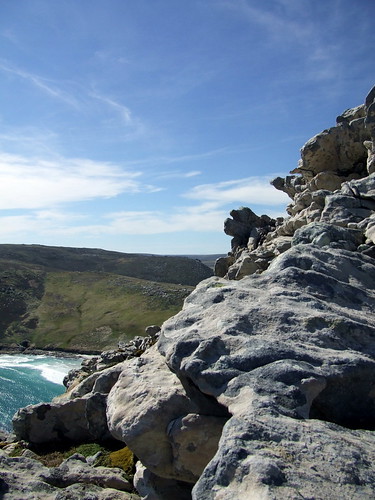 Eroded quartzite on the second peak.
 Second peak, from just below the saddle.
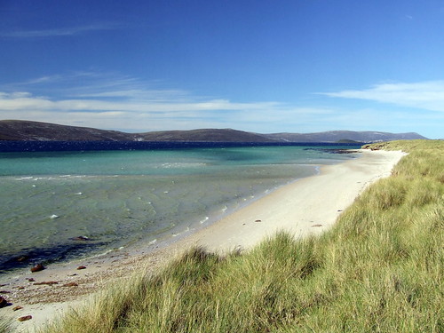 Looking across Port Stephens to the NE from the sandbeach below the peak.
 Calm Head, over 700 feet high, been there but didn't have the nerve to go out onto the head itself (very narrow indeed)
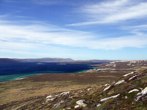 Looking over Port Stephens toward Mt Alice in the distance.
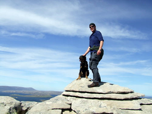 Me & Boom on the top, very windy.


